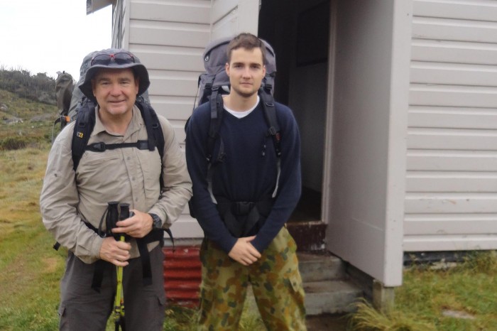
In mid-December 2015, my son Tom and I, set off for a four-day walk across the Jagungal Wilderness area. Located in the centre of Kosciusko National Park north of the main range, the predominant peak in the region is Mount Jagungal (2061m), the seventh highest peak in Australia.
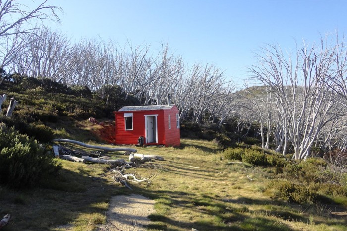
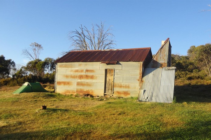
We were pretty lucky with the weather which was generally fine, although a little warm for walking with packs, (maximum around 25 degrees). We planned to camp in our tents next to refuge huts, which are fairly common in the area. Managed by the Kosciusko Huts Association, most of the huts were built some time back with some rebuilt after fire swept through the area in 2003.
Getting There
We drove from Adelaide, staying at Hay overnight, then on to Tumut via Wagga. We had planned to start the walk at the Round Mountain carpark at 4pm however when we reached Cabramurra at 3pm (about 40km from Round Mountain), the road was closed. Apparently the road had been closed for three days prior to us arriving and wouldn’t to be opened until 6pm that evening.
To fill in time, we visited Cabramurra where I learned that the road closure was due to a crane being transported to the Tumut Pondage dam wall to carry out maintenance work. Cabramurra is a classic company town, of employees and families of ‘Snowy Hydro’, the company that operates the hydroelectricity schemes. The information centre had lots of information on the development of the Snowy Hydro scheme and how it operates today. We also learnt that Cabramurra is the highest permanently inhabited town in Australia (1488m).
Finally arriving at the Round Mountain carpark at about 8pm, we set off for a 2km walk along a fire trail and camped overnight at Round Mountain Hut. There was another group of bushwalkers staying at the Hut, one of whom was a barefooted bushwalker! After chatting, I discovered that he had been barefoot for the past eight years. As a member of the Society for Barefoot Living, he advocated its various health benefits.
Day 1 – Round Mountain Hut to O’Keefes Hut
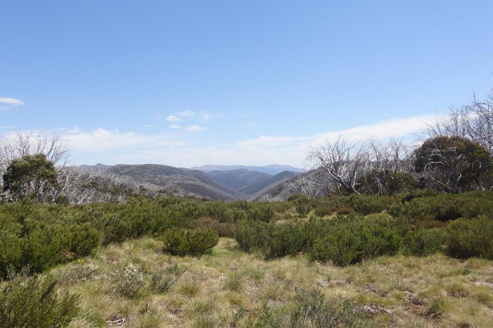
The next day Tom and I headed off (with boots on our feet) along the 12 km Farm Ridge track to O’Keefes Hut, the closest hut to Mt Jagungal. With spectacular subalpine scenery and a couple of creek and river crossings, the trail was easy to follow, although steep in some places.
Evidence of the 2003 bushfires still dominates the landscape. Virtually all the snow gums had been destroyed leaving only dead trunks, some sprouting regrowth from their roots… not much after 12 years. Consequently, there was no shade and constant exposure to the sun zapped our energy.
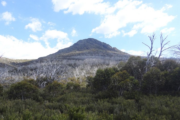
As we reached the end of the Farm Ridge Track we turned south onto the Grey Mare trail where Mount Jagungal loomed in the distance. Our plan was to climb it after reaching camp that afternoon. I had read that a footpad existed from O’Keefes Hut leading up the mountain (albeit steep), and the climb was only about a 6 km round trip. I thought we could easily do this in the afternoon given the days were long at this time of year. We reached O’Keefes at about 2pm, rested and had some lunch. Tom and I then set out in search of the footpad leading up to the summit. We spent three hours working our way through the scrub, searching for a path. The scrub was exceptionally thick and only seemed to get thicker the higher we got. At about 6pm, totally exhausted, we abandoned our climb. Mount Jagungal had defeated us!
We returned to camp a little disillusioned and slept well that night as the temperature dropped to eight degrees.
Day 2 – O’Keefes Hut to Valentines Hut
The next day we headed off along the Grey Mare Trail towards Valentines Hut. After about 5km we came across a group of tents by the Tumut River where one of the walkers informed me that this was the usual ‘basecamp’ for climbing Mt Jagungal. There was a fairly clear path that could be followed and the climb from that direction was much less steep and much less scrub. Tom and I debated whether we should climb it (it would take most of the day), but decided we should push on to Valentines Hut. The walk to Valentines was a long day. All-in-all about 22km south along the Grey Mare trail and then east along the Valentine trail. Again, the subalpine scenery was spectacular with some significant ascents and descents. No shade, and the March flies were fierce. We arrived at Valentines Hut at 4:30pm. The hut is situated next to a beautiful alpine stream with a small beach, perfect for taking a refreshing dip, which we did!
As we approached Valentines Hut we could faintly hear people singing. As we drew closer we could make out the words and tune of a pop song (Taylor Swift I think!) As it happened there were two sisters (aged 16 and 18) camping at the hut for the night too. The older girl had almost completed The Australian Alpine Walking Track and had been on the trail for the last two months to raise awareness of the treatment of refugees. She amused us with some stories of her adventures / misadventures on the trail, including being chased by a bull and close encounters with wild dogs. Her website is worth a look.
Day 3 – Valentines Hut to Dershikos Hut
The next morning the girls headed on to Guthega to meet up with their Dad. Tom and I retraced our steps back along the Valentine Trail and headed north along the Grey Mare Trail. We stopped for lunch at the interesting Grey Mare Hut, which had some derelict mining equipment situated close by. In the afternoon we pushed on to Dershikos Hut, just off the Round Mountain trail. At Dershikos we met a small group from the Wagga Wilderness Walkers club, who were planning to climb Mt Jagungal. That evening, the clouds rolled in followed by thunder, lightning and heavy rain. It was a wild night but our trusty tents managed to keep us dry, even though Tom felt like he was floating on the puddle that had grown under his tent. By dawn the rain stopped and we woke to the final day of our walk. The Wagga Wilderness Walkers abandoned their climb as the now enigmatic Mt Jagungal was engulfed in low cloud.
Day 4 Dershikos Hut to Round Mountain Car Park
The 13 km walk along the Round Mountain track back to the carpark was pleasant with wide, open vistas and a cool breeze. We arrived back at the car by noon and headed off to Cooma where we had a shower, a pub meal and a beer (or two).
Mostly we achieved what we had planned to do, with the exception of climbing Mt Jangungal. That will stay on my list for another day.
[the_ad_group id=”151″]


Comments (1)