The following article was written by Peter Beer in 1963. Much of what he wrote then is just as relevant and useful today. The things that have changed are interesting enough that I’ve added them as footnotes below. Ed.
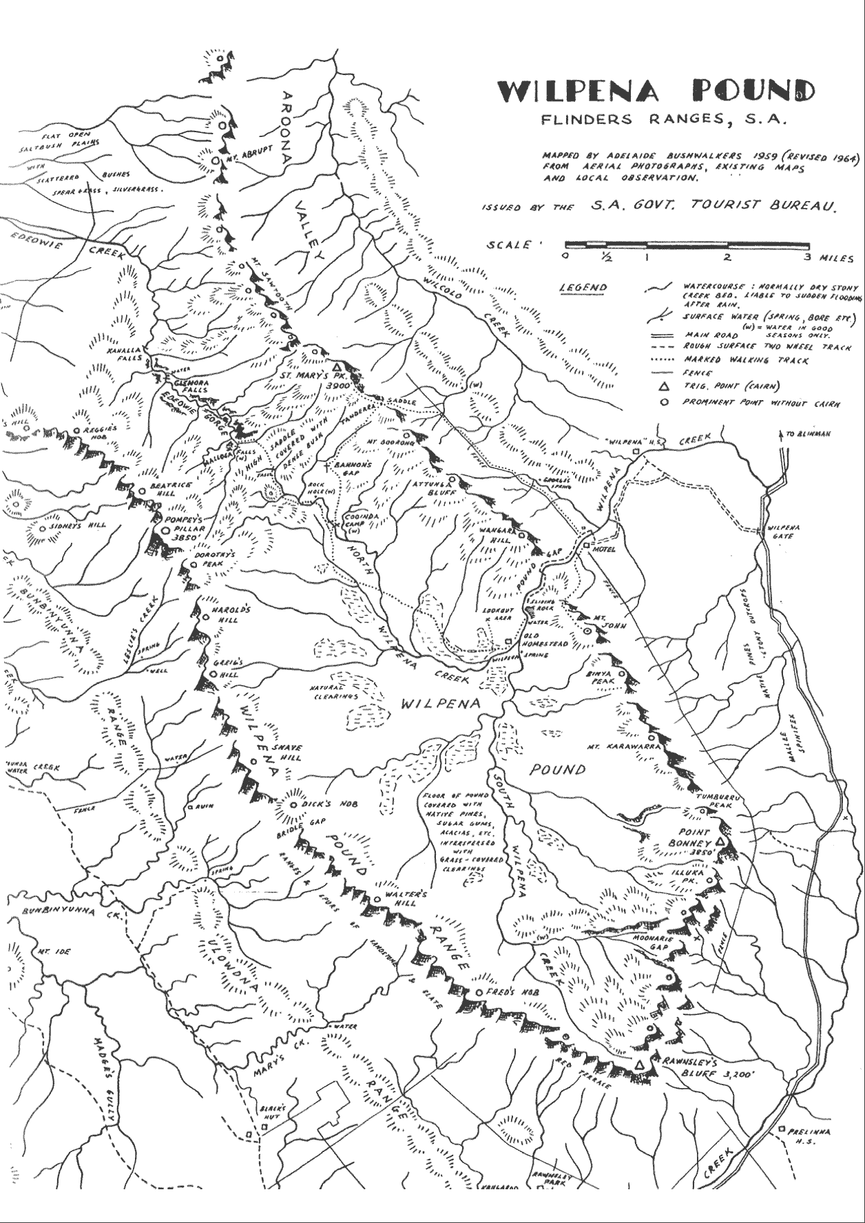
The Pound is a large basin, some ten miles by four miles, drained only by Wilpena Creek, which is permanent near the Chalet[1]. The rock on the summits of the peaks is red quartzite and is underlain by purple slates in the valleys. These rocks make walking hard on the feet, so stout footwear is necessary.

A walking track has been cut from the Chalet to St. Mary’s Peak[2], the highest point in the pound. A return can be made by a recent track running from Tanderra Saddle, back through the Pound. The walk can be done in a day from the Chalet, and is rewarded by one of the most magnificent views in Australia from the top of St. Mary’s[3]. The view takes in the sweeping Aroona Valley to the north, Druids Range in the South East, the Elder Range in the south-west, Lake Torrens in the west, the surrounding plains, and of course, Wilpena Pound itself.
To the west also is rugged Edeowie Gorge, enough to inspire the experienced walker to a visit. This can be done in a three day walk from the Chalet. Walkers often do this by climbing St. Mary’s on the way and camping in Edeowie Gorge at the end of the first day[4].
Heavy scrub is encountered between St. Mary’s and the Gorge[5], but this is soon forgotten when one reaches the Gorge, with its steep, high, red-coloured walls and three waterfalls. The two lower falls, Glenore end Kanalla Falls, drop sheer for over 120 feet and must be negotiated with care. The only way in each case is by ledge from the tops of the falls on the left going down. The exposure at an outjutting rock at the top of the second drop of Kanalla Falls is airy, as it is directly above the drop and it must be negotiated with care.
On reaching the plains at the mouth of Edeowie Gorge the walker is then faced with a climb over the range to the east, camping in Wilcolo Creek[6], and next day returning to the Chalet.

Another interesting two day walk is to Pompey’s Pillar via the inside of the Pound, then down along the outside of the Western Wall of the Pound[7], comping ot one of the springs neer the Bunbinyunna Range[8], and returning via Bridle Gap, a relatively low saddle, to the Chalet. If time allows, this trip can be extended by two days to include Mt. Aleck (2,700 ft.) in the Elder Range, to the west of Wilpena Pound.
Interesting short walks can be made to the summit of Mt. John and also to Mt. Bonney and Rawnsley’s Bluff from the nearby road. Aboriginal paintings may be found in this area[9].
If a party is really ambitious, it could try a skyline traverse of the whole Pound, a difficult dry trip, which would require at least 2 1/2 to 3 days[10].
The walks suggested are only some of many variations possible all of which offer a never-to-be-forgotten experience. In general, in planning a trip, one should aim to camp each night at one of the known water supply points marked on the map.
Rock climbers, too, will find endless faces to climb in this area, although a word of caution is necessary. Some of the rock is rotten and extremely crumbly, and must be treated with care.
Access to the area can be gained from Adelaide by travelling through Port Augusta, Quorn, Hawker and then another 35 miles to Wilpena Chalet. The total distance is close to 300 miles, but is well worth the effort.
Footnotes
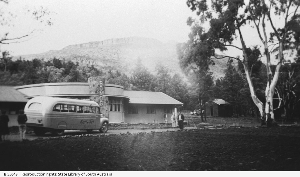
- The Chalet was an early hotel which seems to have been in the same location as the current resort. It was owned by a company which brought tourists in on package holidays.
- Now known as St Mary Peak / Ngarri Mudlanha.
- This track and the one up Mt Ohlssen Bagge was originally cut by ABW members.
- Sadly, increasing human impact has led to the closure of campsites inside Wilpena Pound. The most practical camping option on day 1 may now be on Edeowie Creek once it leaves the park boundary.
- A track has since been cut through this scrub.
- The new Wilcolo campground is walk-in only and one of the nicest in the park.
- The western side of Pompey Pillar is steep and rocky and requires a good head for heights. Or as Peter so eloquently puts it, “airy”.
- These springs appear to be marked on the contemporary map but of course will be unreliable.
- Probably Arkaroo Rock.
- Look for a report of this route in an upcoming edition.
One last change needs to be mentioned, which in no way should be taken as criticism of those who have gone before; a change in our cultural awareness. “St Mary Peak is central to the Adnyamathanha creation story. For this reason the Adnyamathanha people of the Flinders Ranges would prefer that visitors do not climb to the summit of the peak [beyond Tanderra Saddle]. The shorter option to Tanderra Saddle also affords spectacular views.” https://www.walkingsa.org.au/walk/find-a-place-to-walk/st-mary-peak-hike-wilpena-pound/
Next article: An Everest Base Camp Trek
The image at the top is a view into the pound from Tanderra Saddle by Peter Neaum, CC BY 3.0, via Wikimedia Commons


Great article to read – thank you. It is interesting to read that 62 years ago, camping was closed within Wilpena Pound due to human impacts. This region is a favourite of mine to visit so enjoyed Peter’s Beer’s very experienced perspective.