What an epic:
- 3 days
- 104km
- 37.5 hours in boots
- 6,315m vertical gain (72% of the way up to Everest!)
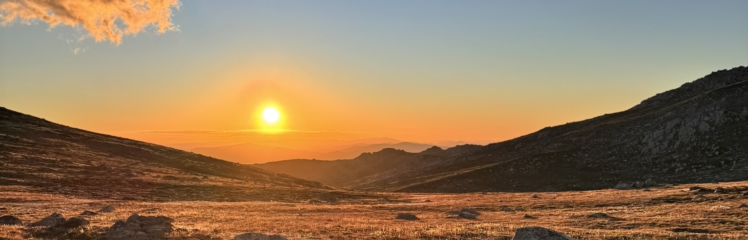
‘The Aussie 10’ is a hike I’ve been planning for years: to summit the highest 10 peaks in Australia; but the timing to do this has been continuously thwarted. These mountains are all conveniently located within the Kosciusko National Park, NSW. Also though, there are very interesting mountains in vicinity of the Aussie 10 – all about or above 2,100m, so my list of summits to climb on this adventure was always going to be higher. This would include Australia’s highest mountain, Kosciusko, at 2,228m.
I long ago set myself this challenge and began mapping out a route. In the meantime, the new Snowies Alpine Trail in this area opened and the opportunity to merge these two notions, along ridgelines on high, was before me.
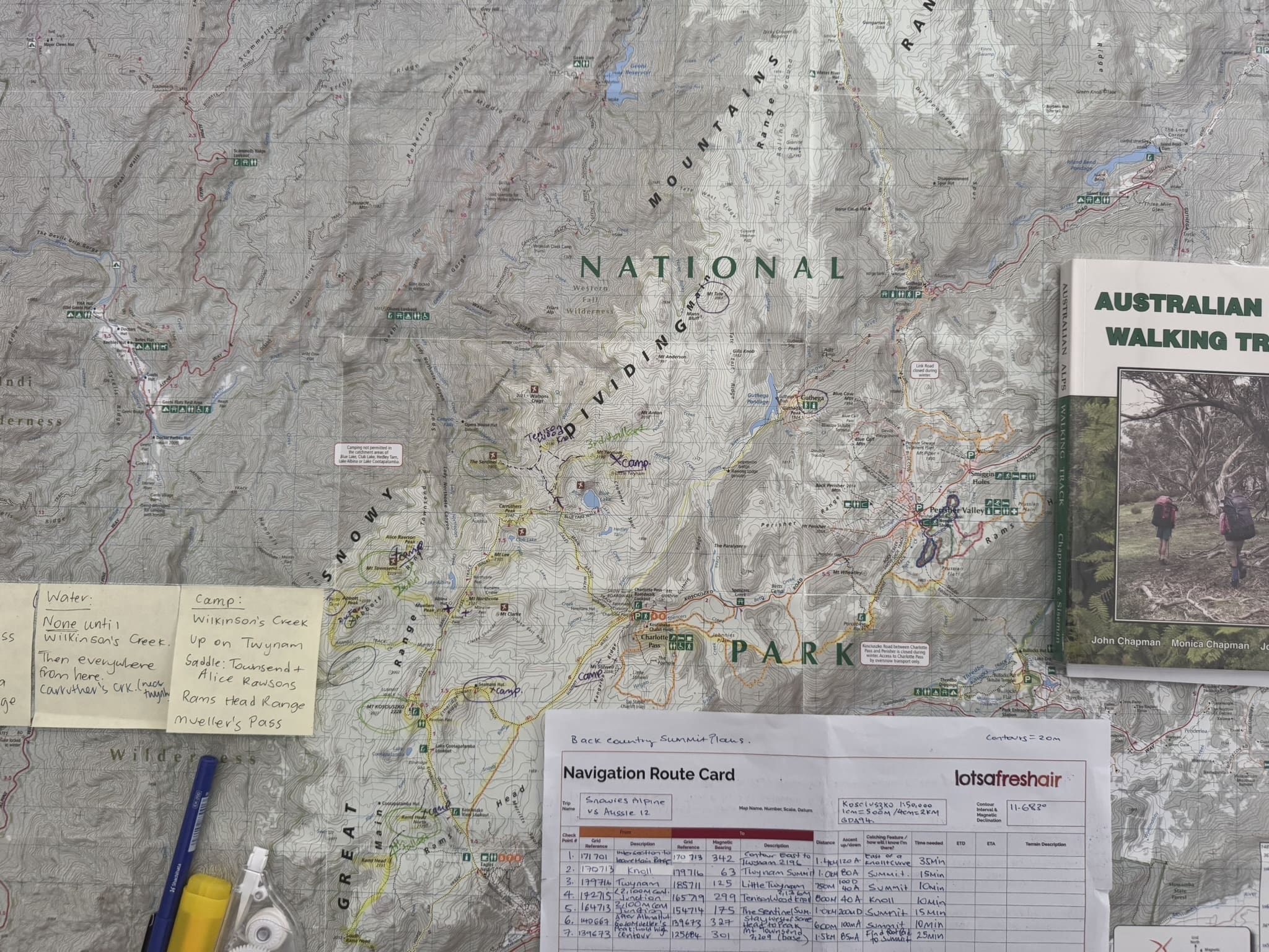
However, during my route plan I somehow found myself to be now at 18 summits. This was about when my time available diminished: I’d now need to complete this within 3 days, not 5.
I wondered just how successful I could be and knew I might have tough choices for summit selections to make. I’m not good odds for making this type of decision though; I’d want them all.
Then a lucky break. Two days before starting, my friend from WA said she would join me! Melissa is a runner and triathlete and brings sunshine and joy to every moment of the day. Her fitness and tenacity kept me on pace and I was never sad when I had her by my side. Mel & I have hiked in Tasmania and Nepal before so I knew we were up for a good adventure.
Day 1
- 33km / 10 hrs in boots
- 9 summits
- 2,380m ascent
- 1,930m descent
We had an early transfer from Bullocks to Guthega by Snowies transfers. Lynne was extremely helpful and went above and beyond as ground support with our luggage and an exit strategy, should we need it.
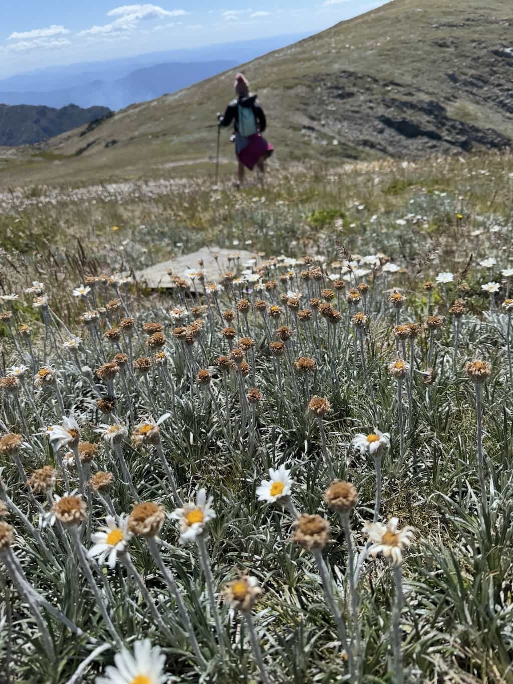
We stayed true to the new Snowies Alpine Trail and 17km on from our start at the Guthega trailhead, we arrived to Charlotte’s Pass then to Twynam, Australia’s third highest mountain. Within this section, Mel had a terrible fall that would have been a trail ender and hospital visit for most people. Mel is incredible and after a patch up, I gave her my poles and we were back on our way.
From Charlottes we pushed up the main range to Blue Lake and on to our turn off to the back country for Twynam and friends. Here at the 20km mark, we finally summited our first mountain and Australia’s third highest, Mt Twynam. From here, our second summit, Little Twynam. I didn’t factor in the need to re-summit Twynam on our return. What an effort!
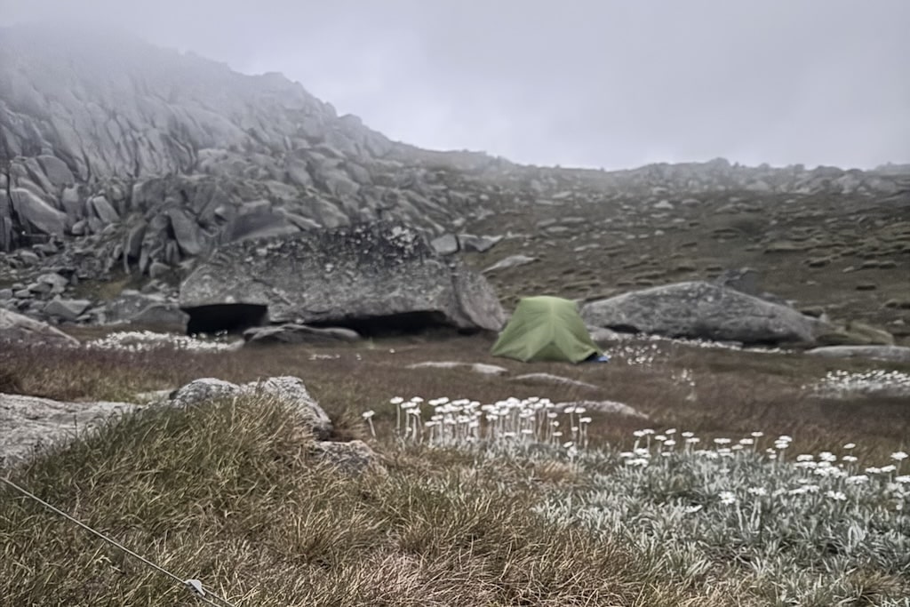
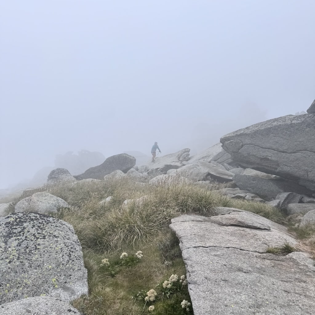
Continuing on our shopping list of summits we came across 95km gusts of wind. We got it done though and soon we pushed on in the back country for 9km to our eventual camp at the base of Mt Townsend via a few other summits. None were easy and daylight was fading fast. Also, it was dry and water spots I knew of were dry. We camped where we found a trickle of water we could filter and sterilise at the base of Townsend, arriving with the sun setting behind us.
Day 1’s Summits
- ⛰️ Twynham 2,196m (3rd!)
- ⛰️ Little Twynam 2,131m
- ⛰️ (Twynam again!)
- ⛰️ Tenison Woods Knoll 2,136m
- ⛰️ Mount Sentinel 1,905m
- ⛰️ Carruthers Peak 2,142m
- ⛰️ Mount Lee 2,105m
- ⛰️ Mount Northcote 2,131m
- ⛰️ Muellers Peak 2,123m
Day 2
- 31km / 14.5 hours in boots
- Another 8 summits
- 1,555m ascent
- 1,603m descent
Our time on Abbott’s Range continued and although we could see and smell a fire on the next range below us, we did not realise the range we were on had been closed after we’d hiked out there. We hiked Hannel’s Spur back to the Main Range when we saw signs that this area was now closed. Next we were hiking Australia’s hiking peak. Kosciuszko was an interesting summit! Such a paved trail all the way back to Thredbo.
Soon after Kosci, we stashed our packs behind rocks, dropped a pin on where they were and went into the back country again in search of the Rams Head Range.
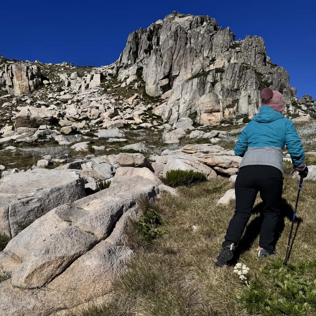
The Rams Head North climb was so much fun but a little sketchy in places. Crossing a great water source further south was Rams Head and this was an ‘easy’ hike up and then on to our furtherest peak, Rams Head South. This one was a monster and broke my heart a bit. I was so exhausted by this point as it was our 8th summit and I think 25th kilometre for the day to get there; with all the kms to go to get to our packs and then to camp. The earlier two summits held over from the day before would be our undoing and we would have two more to hold over for the next day now, and the additional kilometres to do to get to them.
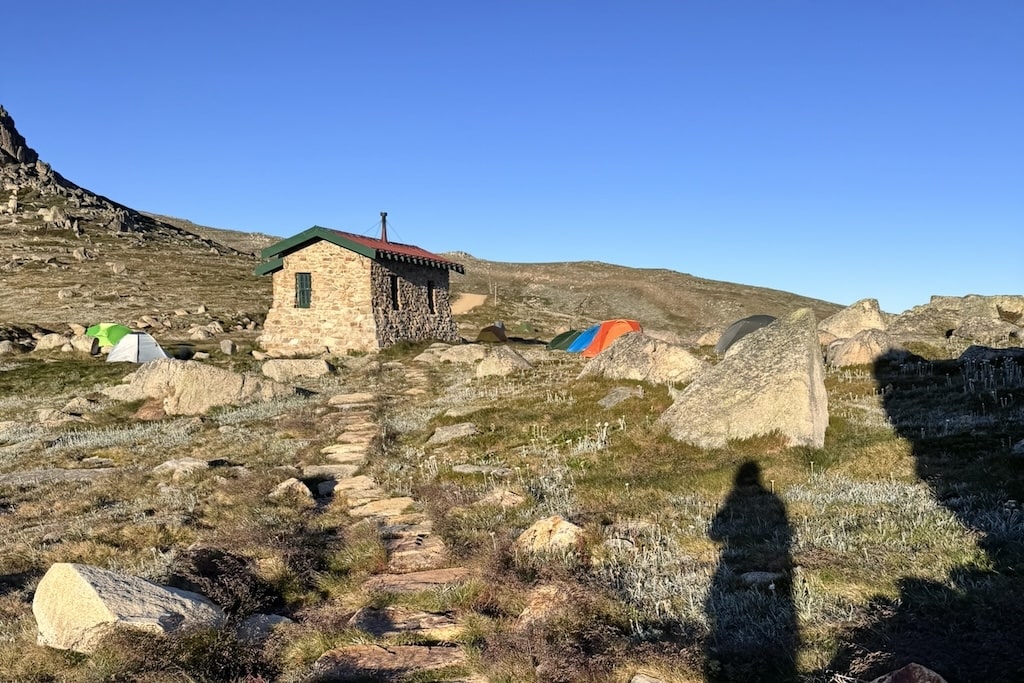
Calculations of daylight and distance determined our most practical camp would be the sanctity of Seaman’s Hut this day. A dry camp but great views! We arrived under head torch having collected water from a stream along the way and found a fellow camper who saw us coming and pointed out a spot for us to camp. Nice guy, saved us time scouting for a good spot as it was after 9pm and we were exhausted. As Mel pointed out when I said this she said my new favourite thing “True hikers aren’t arseholes!” Mel never swears, but she was on point with this.
Day 2’s Summits
- ⛰️ Mount Townsend 2,209m (2nd!!)
- ⛰️ Alice Rawson Peak 2,167m
- ⛰️ Abbott Peak 2,159m
- ⛰️ Mount Du Faur 2,120m
- ⛰️ Mount Kosciuszko 2,228m
- ⛰️ Rams Head North 2,177m
- ⛰️ Rams Head 2,193m
- ⛰️ Rams Head South 2,052m
Day 3
- 39km / 11.25 hours in boots
- The last 2 summits
- 2,380m ascent
- 1,930m descent
Safe to say we both slept like the dead and were in no hurry to embrace this day. From the comfort of Seaman’s Hut we made our way down to the mighty Snowy River and filtered a few litres of water for our most gruelling day yet. Only 2 summits but as has been proven on this trip, none have been easy and some have brought us to our knees. We had almost 40km to cover as well as these two summits and both would be a bit of a bush bash to bag.
We summited and were feeling victorious to have the 18 done!… then pushed on to Charlotte’s Pass village and a great Scottish lass behind the bar filled our nalgenes with iced water; we shared a coke and were back on trail. In truth this Scottish lady knew more than the Snowies visitor centre as this trail section had only been open 3.5 weeks and we had been guessing routes and kms for this section. Perisher was next though via Porcupine Rocks then and out to Bullocks Flat, again finding the mighty Snowy River.
We had a punishing and continuous rise over more ranges until the final 10km, and the kilometres were starting to add up to close to 100 overall for the 3 days. Our bodies were breaking down, we were tired and the heat and abundance of biting March flies were draining. I’m so glad I had brought walkie talkies too as we were often great distances apart and out of sight or sound of each other. This way there no frustrating stops by one or the other; we are both fast so ‘hiked our own hike’ and leap-frogged each other along the way.
Day 3’s Summits
- ⛰️ Etheridge Ridge 2,180m
- ⛰️ Mount Stilwell 2,052m
The Debrief
In hindsight, I have some learnings:
- Walkie talkies are worth the weight
- All hikers should have gpx tracks on app and maps
- A beefed up first aid kit is a really good idea
- Choose your team wisely. I could not have endured or achieved this dream without my super fit and resilient friend.
- Friends at home tracking your Garmin could be a life saver
- Have a number of navigation points written up for each day. At elevation, closed-in weather requires you to navigate in the right direction. If you can’t navigate with confidence, dont hike back country. We had clear views disappear under cloud. There was a hiker missing where we were about the time we were there (since found safe).
- As usual I had too much food and my filter was blocked from my last trip so should have checked this before I left.
This hike plan was extremely optimistic! A ridiculous challenge but with (overall) favourable weather and ample daylight to use wisely; success was always going to be a mental game to battle.
I think Melissa is the hero of this story though. She committed to my dream and made me see it through. She pushed me and was wonderful company and is naturally athletic so although it was the hardest adventure I’d ever had, her various marathons would have been harder. Mel points out we did 2.5 marathons in 3 days; with packs.
I can’t express in words the unrelenting and gruelling nature of our adventure. Our fitness got us through but combined years of on-trail experience, reading the land for water and mental resilience was our ace.
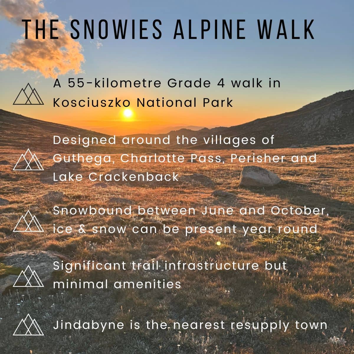
Editor’s note: the Snowies Alpine Walk itself is a much gentler affair!
Next read: What We Know of the 2025 Grampians Fires
Comments (0)