Are you interested in hiking the Larapinta? Hopefully after reading you’ll have a better idea if it’s for you, and what preparation you’ll need. Then you might like to take a look at our 17-day itinerary.
This article is designed as a quick summary of the important points. Additional resources include the excellent official trail site and Chapman’s guide to walking the Larapinta Trail. While all effort has been made to ensure accuracy, please do not rely on this information alone.
When To Go & What To Bring
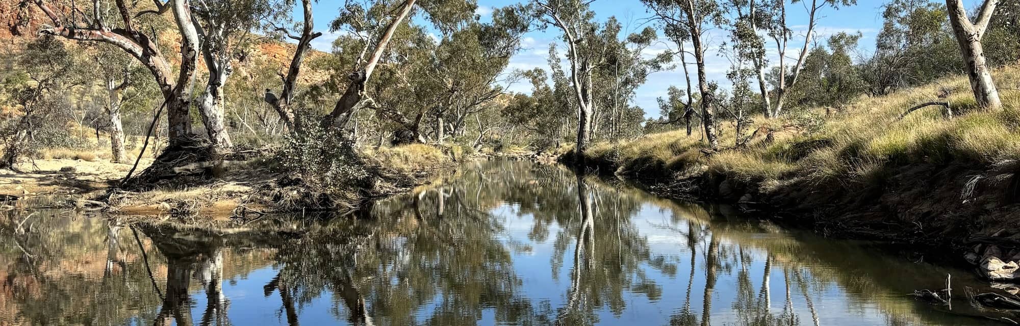
The best months to walk the Larapinta are from May to August. At this time, most days are pleasantly warm and sunny, but you are likely to experience some days over 30ºC, and you will typically have nights below zero.
Therefore, you can experience it all:
- days warm enough to require careful planning of when to break camp and how much water to carry
- high enough UV levels to cause sunburn, even in winter
- nights cold enough to justify a sleeping bag with a -10ºC comfort rating
You will need cool, sun protective clothing for daytimes, warm gear for nights and even rain gear just in case. You should have the ability to carry a minimum 3L of water, and even more in warm weather.
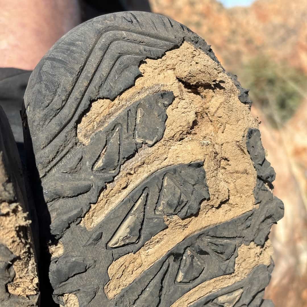
You will need boots or trail shoes tough enough to resist the angular quartzite of the West Macs. By trail’s end, you can expect new shoes to be at least half dead, or old shoes to be on their last legs, at best.
Apart from this short list, the gear you will need is the same as for any extended hike. Mobile reception can be found on many peaks, and Optus reception is available at some of the trailheads.
How Safe Is The Larapinta?
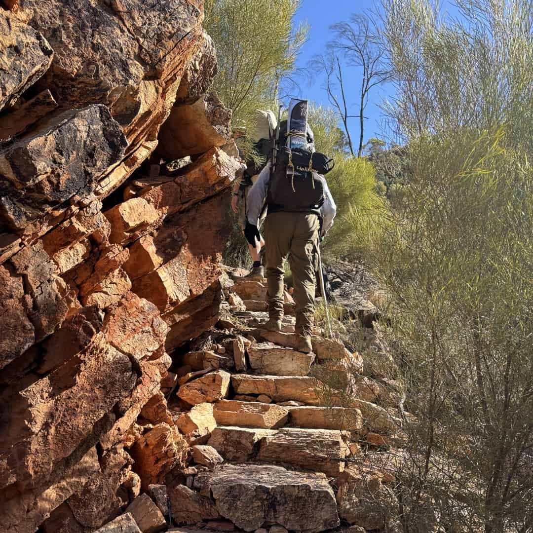
If you are properly prepared, the Larapinta is a relatively safe trail. Most of it is well planned and constructed, but the rockier sections require some care. You can reduce the risk of injury by getting properly trail fit before you come. Many people also find that trekking poles are very helpful on the uneven ground.
Should you suffer an injury, each trailhead has 4WD access. If your group is carrying a satellite messaging device it is reasonably easy to get assistance.
Although snakes are a potential danger, they are rarely seen in winter. If you are worried, wearing knee-high tough gaiters, not stepping where you can’t see your feet, and carrying a compression bandage are all useful tips.
The dingoes are a potential risk, but are far more likely to just be a nuisance by stealing anything edible. Yes, that includes shoes. While on the subject, mice are a significant pest at times. You should be prepared to hang your food bags overnight, although we had no issues on our trip.
Is it Safe For Solo Hikers?
The Larapinta is very popular with soloists, especially women. There are some good reasons why:
- The trail is very busy in the peak season, so you’re never very far from another walker
- The positive, open vibes among trail users make it easy to buddy up, share or get assistance
- Other than Ormiston Gorge and Standley Chasm, the campsites are hiker-only
So the consensus is that it feels safe. However, greater care is required. The few deaths that have occurred would probably not have happened if they were not alone. The first was a US tourist who climbed Mt Sonder on a 40ºC January day and took a wrong turn on the descent, presumably affected by hyperthermia. The second was an experienced hiker who missed a turn and ended up swimming up a gorge, where he appeared to die of hypothermia.
The trail is well-marked and usually quite clear due to the high amount of foot traffic. The exception is the creekbeds, where it disappears in the loose stones. Therefore, extra caution is required to not miss an exit in the gorges. Navigation apps are very handy here.
It’s worth adding that there are many companies offering guided hiking experiences if you want to do it with extra support, solo or otherwise.
How Long Does The Larapinta Take?
The Larapinta Trail is divided into 12 sections, and so many people do the walk in these 12-day divisions. As each trailhead is a higher-level campsite with water tank and toilet, this is not illogical. However, you will miss out on some spectacular intermediate campsites and may find the schedule of long and short days a bit inflexible.
We chose to do the walk in a very relaxed 17-day timeframe. This allowed for:
- rest days if we needed them
- a side trip to Mt Giles
- late starts or mid afternoon finishes (we were often able to choose the best spots at each campsite)
We could also camp in some interesting places. You can read a detailed account of our itinerary here.
Larapinta Trail Campsites
The first thing to know is how great the main campsites are. We only saw one toilet run out of toilet paper and the water tanks were always full. Most have a large shelter with food storage areas and platforms you can prepare food at or sleep on, but be warned: it gets very cold at night and the early risers will wake you up.
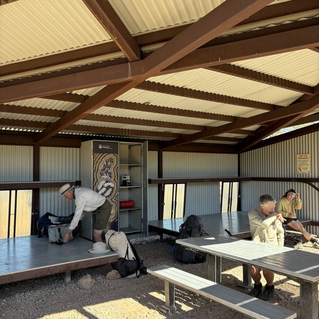
The USB charging points in the shelters seem to only work during the height of the day due to the angle of the panels and the lack of a battery. Don’t rely on these. Charged battery banks in our food drops, and a 5W solar panel worked well for us.
Although excellent, the toilets are smelly, and being built from steel, are also very noisy. Try to camp away from them if you can. There are also toilets and water tanks found in mid-section campsites at Wallaby Gap (S1), Mulga Gap (S6) and Rocky Bar Gap (S11).
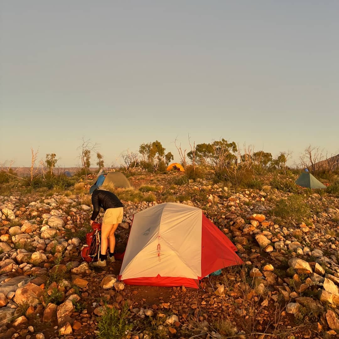
Alternative Larapinta campsites can be found along every section. Many are mentioned in the guides; you can recognise them by the tent spaces cleared of rocks. Particular favourites are Hilltop Lookout, Counts Point and Brinkley Bluff where you will get sunset and sunrise views, plus Mt Giles if you do the side trip. Other hikers are a great source of info on these.
The campsites without toilets are not without their faults. In such a dry environment, the senses are often accosted by poorly located comfort stops of all vintages. Tip: walk further away than you usually would, and pull up a large rock to use the hole underneath. Don’t pee too close to camp either, because there’s no rain to rinse it away before it pongs.
Food & Water
If you’re walking unsupported, unless you’re a walking beast, you’ll need to organise food drops.
There are three food drop points: Ormiston Gorge and Ellery Creek South have official lockup sites, plus an unlocked room at Standley Chasm. You can arrange keys from the tourist centre in the mall in Alice Springs.
We chose food drops at Serpentine Gorge and Standley Chasm, meaning we carried food for 6, 6 and 4 days. Our transport company provided the keys and containers that they dropped off and then collected later (which we had filled with our rubbish and surplus gear).
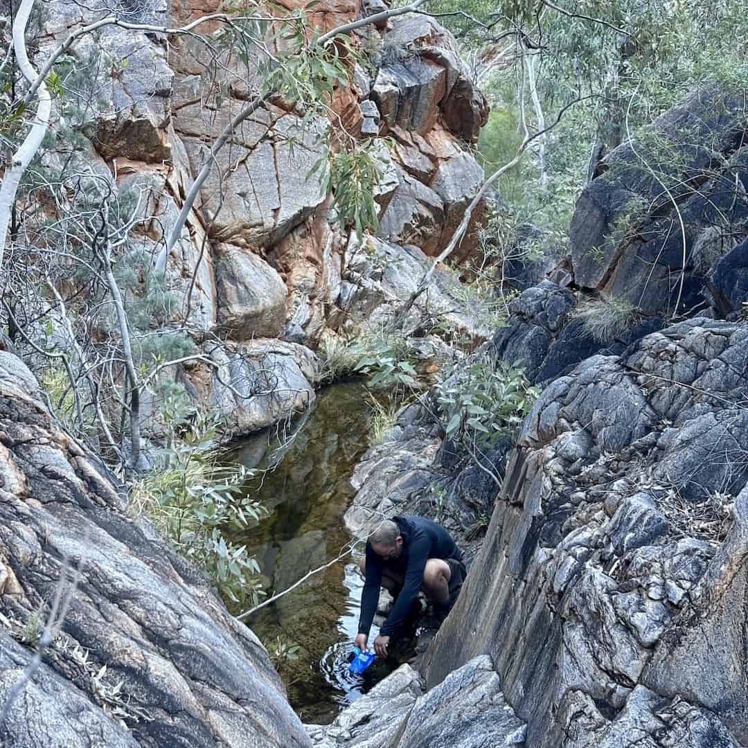
Apart from the tanks, there are a lot of waterholes along the trail. You can find out if there’s water in them by asking walkers going the opposite way. Of course, this water needs treatment before drinking.
Larapinta Trail Costs
Here is what we found when booking the trail in 2024:
- You need an NT Parks pass for $60 which isn’t valid for Uluru/KataTjuta
- There is a Walking Trail fee of $25 per day up to a maximum of $125
- Each campsite booking costs $10 and the system forces you to select one for each day though they seem quite relaxed if your itinerary changes
- Standley Chasm is privately operated and costs $30
Yes, it’s more expensive than most trails, but once you’re there at least you can see where the money goes. Infrastructure is top-level and the trail conditions are some of the best in Australia. The Larapinta is one of Australia’s premier trails, and is almost a must-do for anyone interested in multi-day walks.
Next read: A Larapinta Trail 17 Day Itinerary
Comments (0)